
Click on the chart to see enlarged
I’m a bit late picking up on this but,
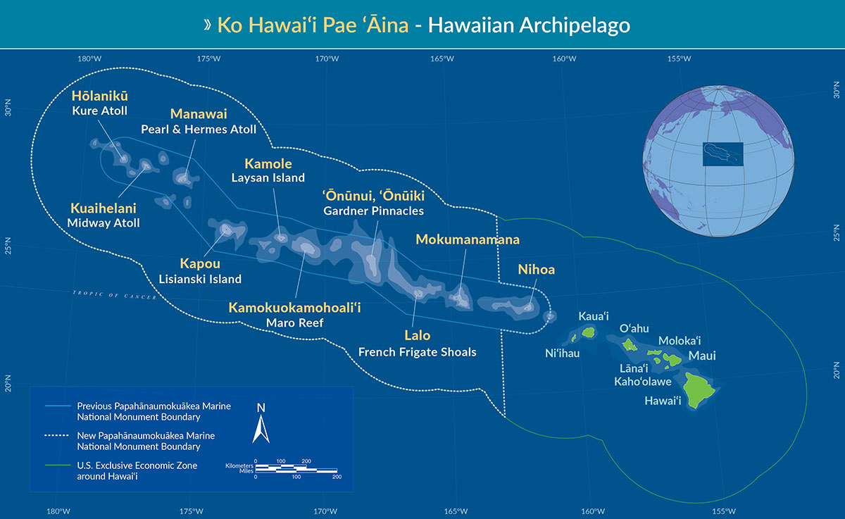
On Friday, August 26, 2016, President Obama signed a proclamation expanding the Papahānaumokuākea Marine National Monument. Previously the largest contiguous fully-protected conservation area in the United States at 139,797 square miles (362,073 km2), the expanded boundaries make it once again the biggest protected area on the planet at 582,578 square miles (1,508,870 km2) (439,916 sq nm–Chuck), nearly the size of the Gulf of Mexico.
“Papahānaumokuākea is globally recognized for its biological and cultural significance, being the only mixed UNESCO World Heritage site in the United States and only one of 35 mixed sites in the world. Its long list of protections includes designation as a Particularly Sensitive Sea Area by the International Maritime Organization. See full list of protections here.
This was before announcement of the slightly larger Marine Protected Areas recently announced in the Ross Sea off Antarctica (1,550,000 sq km or 451,908 sq nmiles). It is in addition to the recently expanded Pacific Remote Islands Marine National Monument (approximately 1,269,090 sq km or 370,007 sq nm).
My question regarding how these sanctuaries will be enforced remains.
