

Orthographic projection of Greenland. Credit Connormah via Wikipedia
The US Naval Institute blog has a proposal from Ensign Philip Kiley, U.S. Coast Guard Reserve that the Coast Guard reestablish a “Greenland Patrol.” This seems to have been prompted by the recent deployments of WMECs Tahoma and Campbell to participate in Canadian sponsored Exercise Nanook.
I agree Greenland is strategically important. I also believe that if we build three heavy and three medium icebreakers, we will have one or two of the medium icebreakers on the Atlantic side, maybe all three. Its just that a Greenland Patrol, as discussed, is not an adequate rationale. At least, the thesis is not adequately developed to support the proposal.
What would the Coast Guard do that the Danes are not already doing?
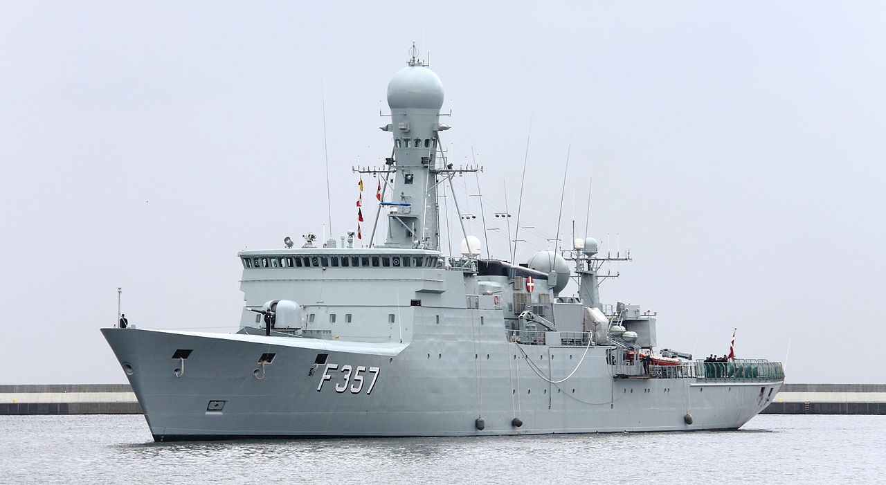
Thetis-class ocean patrol vessel belonging to the Royal Danish Navy. Source: konflikty.pl, Author: Łukasz Golowanow
The Danish Navy already does a “Greenland Patrol” and they may be better equipped to do it than the US Coast Guard. They certainly have more reason to be there. The have seven ice-strengthened patrol ships, four ships of the 368 foot Thetis class and three of the 236 foot Knud Rasmussen class.

P570 Knud Rasmussen. The first of the Danish Navy Knud Rasmussen-class ocean patrol crafts. Commisioned in 2008. Photo from Flemming Sørensen
The US Coast Guard currently has no ice-strengthened patrol ships, and has no plans to build any, unless we consider the proposed medium icebreakers, aka “Arctic Security Cutter.”
When US Coast Guard was doing the Greenland Patrol in WWII, it included ice-strengthened ships with significant armaments, including ultimately Wind class icebreakers with four 5″ guns. The Danish ships are armed with 76mm guns and the ability to add StanFlex modules that might include surface to surface and surface to air missiles.
If the “Arctic Security Cutters” could fit through the St. Lawrence Seaway, they could break ice in the Great Lakes in the winter and support DOD construction in the Arctic during the Summer. Presumably, when the High Latitude study determined that the Coast Guard needed three heavy and three medium icebreakers they had enough missions planned to justify their construction without adding a Greenland patrol.
On the other hand, its entirely possible we still have much to learn from the Danes.


