ALCOAST 321/20 – AUG 2020 SOLICITATION FOR RESEARCH DEVELOPMENT TEST AND EVALUATION (RDT&E) IDEAS

Below is a solicitation. Hopefully it will generate some ideas. We have a good group here that might have some suggestions. 

ALCOAST 321/20 – AUG 2020 SOLICITATION FOR RESEARCH DEVELOPMENT TEST AND EVALUATION (RDT&E) IDEAS

R 271021 AUG 20
FM COMDT COGARD WASHINGTON DC//CG-9//
TO ALCOAST
UNCLAS //N03900//
ALCOAST 321/20
COMDTNOTE 3900
SUBJ:  SOLICITATION FOR RESEARCH DEVELOPMENT TEST AND EVALUATION (RDT&E) IDEAS
1. The Research, Development, Test & Evaluation (RDT&E) and Innovation Program
invites all military, civilian, reserve, auxiliary, and contractor personnel to
submit research project ideas for the FY22 RDT&E Project Portfolio. Visit the
Coast Guard’s crowdsourcing platform, CG_Ideas@Work
(https://cg-ideasatwork.ideascalegov.com), and submit ideas directly to:
https://cg-ideasatwork.ideascalegov.com/a/ideas/recent/campaigns/1078.
2. If you do not yet have a CG_Ideas@Work account, you can easily register using
your ‘.mil’ email address to access the platform from any personal or Coast Guard
device. If you are unable to access the idea submission form, please submit your
idea via email to: research@uscg.mil including your idea title, a short summary,
and your contact information.
3. The deadline to submit ideas for the FY22 RDT&E Project Portfolio is 11 SEP 2020.
Project ideas will be reviewed and ranked by stakeholders from across the service
at an Idea Submission Review in 1st Quarter FY21.
4. The Coast Guard’s senior leadership has identified the following research priorities:
    a. Growing Advanced Computing Capabilities to Maximize Readiness. How can we apply
artificial intelligence, machine learning, and advanced analytics to manage risk and
make decisions based on data?
    b. Continued Development of Mobile Solutions to Deliver Mission Excellence Anytime,
Anywhere. What mobile-enhanced tools can we provide to our members to improve the Coast
Guard’s operational impact and mission support delivery?
    c. Utilize Autonomous Systems to Address the Nation’s Complex Maritime Challenges.
How can we integrate unmanned aerial systems (UAS), unmanned surface vehicles (USV),
and unmanned underwater vehicles (UUV) to improve operational safety, effectiveness,
and efficiency?
    d. Strengthen Resilience, Safety, and Security of Coast Guard systems and personnel
to Deliver Mission Excellence Anytime, Anywhere. What tools or ways of doing business
can improve our members’ safety and security and position the Coast Guard to take on
complex and difficult to predict challenges like COVID-19 and emerging cyber threats?
    e. Develop Human Machine Teaming to Maximize Readiness. How can we manage the
relationship between our people and automated systems in a way that maximizes the
capabilities of humans and machines while guarding against complacency and the loss of
key skills?
    f. Maximize Readiness Today and Tomorrow by Enhancing C5I capabilities.
What command, control, communications, computers, cyber, and intelligence
capabilities can we put in the field to make the Coast Guard more ready and more agile?
5. Not all great ideas fit in the priorities above. All potential research project
ideas will be reviewed and considered. Your ideas and input are requested.
For inspiration, check out the current RDT&E Project Portfolio and website here:
http://www.dcms.uscg.mil/acquisition/rdte.
6. POC: Ms. Alexandra Swan, COMDT (CG-926), at: 202-309-8255 or
Alexandra.P.Swan@uscg.mil.
7. RADM M. J. Johnston, Assistant Commandant for Acquisition and Chief Acquisition
Officer, sends.
8. Internet release is authorized.

Growth in Arctic Shipping –Pollution Worries

The Coast Guard Cutter Healy breaks ice around the Russian-flagged tanker Renda 250 miles south of Nome Jan. 6, 2012. The vessels are transiting through ice up to five-feet thick in this area. The 370-foot tanker Renda will have to go through more than 300 miles of sea ice to get to Nome, a city of about 3,500 people on the western Alaska coastline that did not get its last pre-winter fuel delivery because of a massive storm. If the delivery of diesel fuel and unleaded gasoline is not made, the city likely will run short of fuel supplies before another barge delivery can be made in spring. (AP Photo/US Coast Guard – Petty Officer 1st Class Sara Francis) NY112

gCaptain has an interesting article that tracks the growth of shipping in the Arctic and accompanying environmental concerns.

“Russian Warships Sailed ‘Right Through’ Alaska Fishing Fleet: Sailors” –Newsweek

Northeast Russia and Alaska are in close proximity and the U.S. Coast Guard will interact more and more as Russian maritime activity in the Arctic grows. Photo: Shutterstock

There is a Newsweek report of Russian vessels engaged in exercises disrupting fishing in the US EEZ.

“Three warships and two support vessels of theirs were coming and would not turn,” Elliott said from aboard the Vesteraalen. “And they came marching right through the fleet.”

This was in International Waters so it is not that the Russian vessels were violating international law by their presence. They may have violated the “nautical rules of the road”, but that is not clear. Certainly there was no reason to choose the waters for the exercise that they did, other than muscle flexing. It is not a choice a good neighbor would have made.

The fishermen also seemed to feel they had not been informed the Russians were going to be there. “We were caught by surprise” Perhaps we might have done more about that.

A Reevaluation, Ruminating on Homeports While Playing the Red Cell, Part 1

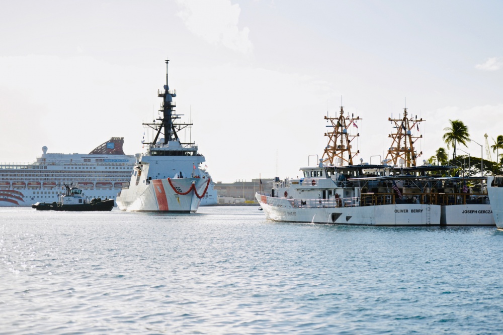
The crew of USCGC Kimball (WMSL 756) arrive in Honolulu for the first time Dec. 22, 2018. Known as the Legend-class, NSCs are designed to be the flagships of the Coast Guard’s fleet, capable of executing the most challenging national security missions, including support to U.S. combatant commanders. (U.S. Coast Guard photo by Chief Petty Officer Sara Muir/Released)

This is going to be an update of a post published 22 Nov. 2015. “Ruminating on Homeports While Playing the Red Cell.” A recently published “National Fleet Plan” prompted that examination. Unfortunately there has apparently been no later edition of this plan. I am going to publish in two parts because was getting a bit long. Part 1 will get us to where we are now. Part 2 will speculate on the future.

Again I will try to identify those ports most at risk of attack, and where the cutters that might protect them are or should be. Much of the organization, logic and even wording of the earlier post will be recycled here. Unfortunately truly current information was not available for each type of port. In some cases the information predated the previous post. I have tried to label the sources and include the year of its publication in parenthesis.

Once again, I looked at this from the point of view of hopefully making an intercept off shore, rather than inside the port, so rather than look at specific ports, in some cases, I clustered ports that had a common approach, e.g. Portsmouth, Norfolk, and Newport News all share a common approach so I grouped them together in what I will refer to as the Chesapeake Bay Complex. Other groups were ports along the Mississippi River, Sabine Pass, Galveston Bay, San Francisco Bay, and Puget Sound. I also disregarded Inland and Great Lakes ports as being protected by the long approach required.

In the original post I was looking to the larger cutters, (NSCs, OPCs, WHECs, WMECs) as the primary protectors of ports, because that was the way the Coast Guard looked at the problem. I have come to believe strongly that Webber class WPCs and perhaps the replacement for the 87 foot WPBs will be much more likely to be in the right place at the right time to counter an attack. The larger ships simply spend very little time underway in the vicinity of their homeports. They spend no significant time on standby (although that could change), and once in port, they usually enter maintenance status, making it difficult, if not impossible, to get them underway promptly in an emergency. That is not to say we will not also look at where the larger ships are based.,

Unlike the previous post, we will look at where Webber class FRCs are homeported. That means this could also be considered a reexamination of a March 2018 post, Homeports 2035.

The larger ships could become significant players in protecting ports if they were equipped with long range Anti-Ship Cruise Missiles (ASCMs) (and here) that could reach from the ships’ patrol areas back to the approaches to the ports.

The Threats: 

Terrorists or even state actors could use any size vessel from personal watercraft to 1000 foot long ships.

  • It could be similar to the 2008 Mumbai attack when a fishing boat was used to put ten terrorist ashore with automatic weapons and explosives. As a result, at least 174 people died, including 9 attackers, and more than 300 were wounded. An attack on the US might include many more than ten individuals.
  • The vessel itself might be weaponize as a delivery system for explosives or for  weapons of mass destruction.
  • Mines might be laid off one or more port to disrupt the the economy or to delay response to acts of aggression.
  • The war in Yemen has shown that terrorist groups are capable of launching attacks using cruise missile and long range weaponized drones. State actors have even greater similar capabilities (and here).

Thinking about response time:

The Coast Guard would certainly like a comprehensive Maritime Domain Awareness system, but so far we still seem a long way from having one. We still have not gotten the land based Unmanned Air Systems that were supposed to have been part of the Deepwater Program.

Even in best cases, unless we have prior intelligence, we are unlikely to recognize a clandestine threat before it enters the EEZ. Even then it is unlikely to be recognized immediately. At 20 knots that puts the adversary ten hours from his target. It could be more. It could be much less.

In some places Geography works against us. An adversary can get very close to some targets by approaching through Mexican or Canadian waters, before entering the US EEZ.

Right of innocent passage means ships can transit close to the US without the need for a Notice of Arrival.

After initial detection, it is going to take some time to determine that an intercept is needed, and more time to communicated the decision. We cannot expect a cutter to make long transits to affect an intercept, so if the cutter is in or near the port to be protected, we are more likely to be able to make a successful  intercept. Probably if the cutter is not able to get underway and intercept the threat in the approaches in less than five hours, it is probably too far away. I would feel a lot better if it were within two hours.

Ports that may need protection:

Lets look at what ports need to be protected, based on characteristics that might make a port a potential target. Look at it both from the point of view of a terrorist, “How can I hurt the United States and make the biggest impact?” and from the point of view of a hostile state, “Where can I best intimidate and dull response to my aggressive actions?”

Cultural Targets: Since the terrorists targets are more about psychological impact than economic or military significance, attacking certain cities may be more important than the actual damage done. Cities that likely figure large in their psyches are:

  • New York City–symbol of American capitalism
  • Washington, DC–seat of Government and the Pentagon
  • Los Angeles (Hollywood)–exporter of American culture
  • San Francisco–as symbol of “alternate lifestyles” that many terrorist groups find abhorrent.

Military Targets: Symbols of American military power, that terrorist groups would like to show are not invulnerable. Also important military targets.

Plus, if they could also at least raise the possibility of a spill of radioactive material, so much the better. So nuclear powered ships of any kind are likely targets.

  • Aircraft Carriers are homeported in three ports: Norfolk, VA; San Diego, CA; Naval Base Kitsap, WA
  • Ballistic Missile Submarines in two: Kings Bay, GA, Bangor, WA
  • SSNs in six ports: Groton, CT; Norfolk, VA, San Diego, CA; Bremerton, WA; Pearl Harbor; Guam

The USN homeports surface combatants in only five distinct geographic areas,

  • Chesapeake Bay (Norfolk and Little Creek, VA);
  • Mayport, FL,
  • San Diego, CA;
  • Puget Sound; and
  • Pearl Harbor, HI.

The Navy is increasingly concentrated geographically. Navy ships generally are in maintenance, in training, deployed far from the US. or are in transit. They no longer routinely patrol US waters. This may not be a problem if you can handle a problem with aircraft, but reaction to a vessel that we suspect may be attempting a terrorist attack will almost certainly require investigation, including, most probably, an attempt to board.

The Navy has no surface combatants in the Atlantic Fleet homeported North of Virginia. We cannot rely on the Navy to provide platforms for intercepts, with the possible exception of off San Diego and Chesapeake Bay.

Attacks on Shipyards that build USN ships might also provide an opportunity to strike at US symbols of power. Notable shipyards are BIW in Bath, Me; Electric Boat in Groton, CT; Newport News in the Chesapeake Bay complex, VA; Austal USA in Mobile, AL; HII in Pascagoula, MS; and NASSCO in San Diego, CA.

Cruise Ships: Another likely target for a terrorist is a cruise ship. The Top Cruise Ship Ports (2011) (arranged geographically):

  • New York, NY, #4
  • Cape Liberty, NJ, #13
  • Baltimore, MD, #12
  • Charleston, SC, #15
  • Jacksonville, FL, #14
  • Port Canaveral, FL, #3
  • Fort Lauderdale, FL, #2
  • Miami, FL, #1
  • Tampa, FL, #7
  • San Juan, PR, #5
  • New Orleans, LA, #10
  • Galveston, TX, #6
  • Long Beach, CA, #9
  • Los Angeles, CA, #11
  • Seattle, WA, #8

Two ports not listed above, that figure prominently as cruise ship ports mentioned by other sources were the US Virgin Islands and Boston.

Container Ports: Attacking a large container ports might also be seen as a good way to disrupt the economy. Top Container Ports (2009, “updated May 20, 2017”) arranged geographically.

  • New York, NY/NJ, #3
  • Baltimore, MD, #13
  • Norfolk, VA, #5
  • Charleston, SC, #7
  • Savannah, GA, #4
  • Port Everglades, FL, #11
  • Miami, FL, #12
  • San Juan, PR, #15
  • New Orleans, LA, #14
  • Houston, TX, #8
  • Los Angeles, CA, #1
  • Long Beach, CA, #2
  • Oakland, CA, #6
  • Seattle, WA, #9
  • Tacoma, WA, #10

Top Ports by Tonnage: More generally, Top US waterports by tonnage (2018) arranged geographically:

  • New York, NY and NJ, #3
  • Baltimore, MD, # 14
  • Port of Virginia, VA, #9
  • Mobile, AL, #11
  • Port of South Louisiana, LA #1
  • New Orleans, LA, #6
  • Baton Rouge, LA, #8
  • Lake Charles, LA, #12
  • Port of Plaquemines, LA, #13
  • Beaumont, TX, #4
  • Houston, TX, #2
  • Texas City, TX, #15
  • Corpus Christi, TX, #5
  • Long Beach, CA, #7
  • Los Angeles, CA, #10

Bureau of Transportation Statistics: I also used the Bureau of Transportation Statistic “List of Top 25 Tonnage, Container, and Dry Bulk Ports” as a check. It made me look at three additional ports:

  • Wilmington, DE part of the Delaware Bay Complex along with Philadelphia.
  • Kahului, Maui, HI, a small container port.
  • Valdez, AK, near the head of a deep fjord in the Prince William Sound

I decided they did not need to be added to the list of ports.

Strategic Ports: Aside from the naval targets listed above MARAD has designated 17 ports for outload of military equipment. These are referred to as Strategic Seaports” (2020):

  • Philadelphia, PA
  • Hampton Roads, VA
  • Morehead City, NC
  • Wilmington, NC
  • Charleston, SC
  • Savannah, GA
  • Jacksonville, FL
  • Gulfport, MS
  • Beaumont, TX
  • Port Arthur, TX
  • Corpus Christi, TX
  • San Diego, CA
  • Long Beach, CA
  • Oakland, CA
  • Tacoma, WA
  • Guam
  • Anchorage, AK

Consolidated Target and Homeport List:

Obviously there is some overlap from list to list. Putting them all together and grouping them by district we get 31 potential target ports in bold. Also included are the location 23 current or planned cutter homeports with the cutters in bold.

CCGD1:

  • Bath, Me–Major Naval shipbuilder
  • Kittery, ME/Portsmouth, NH –Naval Shipyard: 2×270(908, 909)
  • Boston, MA: 3×270 (905, 906, 907)
  • Newport, RI Plan to add 2xOPC (919, 920)
  • Groton, CT–Submarine base
  • Hudson River complex, New York, NY/Elizabeth and Bayonne, NJ–a major cultural target, #3 US Port by tonnage, #3 Container port, #4 Cruise ship port (NYC) and #13 cruise ship port (Cape Liberty, NJ)

CCGD5:

  • Delaware Bay/River Complex–Strategic Seaport (Philadelphia), Wilmington DE/Cape May, NJ: 3xFRC (1119, 1120, 1135)
  • Chesapeake Bay Complex, VA–Base for aircraft carriers and submarines, Major naval shipbuilder, Strategic Port, #9 port by tonnage, #5 container port; plus water route to Washington, DC (major cultural target) and Baltimore, MD–#14 port by tonnage, #13 container port, #12 cruise ship port/6×270 (Portsmouth 901, 902, 903,904, 911, 912), 2×210 (Little Creek 626, 627)
  • Morehead City, NC–Strategic Seaport/Atlantic Beach, NC: 2xFRC (1127, 1128)
  • Cape Fear River–Strategic Seaport, Wilmington, NC

CCGD7:

  • Charleston, SC–#7 container port, #15 cruise ship port, Strategic Seaport/ 2xNSC (753, 754) Plan to add 3xNSC (758, 759, 760)
  • Savannah, GA–#4 container port, Strategic Seaport
  • Jacksonville complex, FL (including Kings Bay, GA)–SSBNs, Navy Base Mayport, #14 cruise ship port, Strategic Seaport/ Mayport, FL: 1×210 (617)
  • Port Canaveral, FL–#3 Cruise Ship port/ Cape Canaveral, FL: 2×210 (619, 621)
  • Port Everglades/Fort Lauderdale, FL–#11 container port, #2 Cruise Ship port
  • Miami, FL–#12 container port, #1 Cruise Ship port/ 6xFRC (1101 to 1106)
  • Key West, FL: 2×270 (910, 913), 6xFRC (1107 to 1112)
  • San Juan, PR–#5 Cruise Ship port, #15 container port/ 7xFRC (1113 to 1118, 1133)
  • Tampa, FL–#7 Cruise Ship port/
  • St. Petersburg, FL: 2×210 (620, 625)

CCGD8

  • Pensacola, FL–4×210 (615, 616, 624, 629),
  • Mobile, AL–major naval shipbuilder, #11 port by tonnage
  • Pascagoula, MS–major naval shipbuilder/2xFRC (1123,  1125)
  • Gulfport, MS–Strategic Seaport
  • Mississippi River Complex, LA–New Orleans #6 port by tonnage, #14 container port, +#10 Cruise Ship port; South Louisiana #1 port by tonnage; Baton Rouge #8 port by tonnage; Port of Plaquemines #13 port by tonnage.
  • Lake Charles, LA–#12 port by tonnage
  • Sabine Pass complex (Beaumont/Port Author/Orange, TX)–#4 port by tonnage (Beaumont), Strategic Seaport (both Beaumont and Port Author), It also has an LNG exporting terminal
  • Houston/Galveston/Texas City, TX–#2 port by tonnage (Houston),  #13 port by tonnage (Texas City), #5 container port (Houston), #6 Cruise ship port (Galveston)/Galveston, TX: 3xFRC (1136, 1137, 1138)
  • Corpus Christi, TX–#7 port by tonnage, Strategic Seaport

CCGD11:

  • San Diego, CA–Base for aircraft carriers and submarines, major naval shipbuilder (NASSCO), Strategic Seaport
  • Los Angeles/Long Beach/Port Hueneme, CA–A major cultural target, #5 port by tonnage (Long Beach), #9 port by tonnage (Los Angeles), #1 container port (Los Angeles), #3 container port (Long Beach), #9 cruise Ship port (Long Beach), #11 cruise ship port (Los Angeles), Strategic Seaport (Long Beach and Port Hueneme)/San Pedro: 4xFRC (1129 to 1132) Plan to add 2xOPC (915, 916)
  • San Francisco Bay complex,, CA–A major cultural target, #6 container port (Oakland), Strategic Seaport (Oakland and Concord)/Alameda, CA: 4xNSC (750, 751, 752, 755)

CCGD13:

  • Warrenton, OR: 2×210 Plan to add two FRCs (Longview, WA is a significant port, but it is 66 miles up the Columbia River, so unlikely to be a target)
  • Puget Sound Complex, Seattle/Tacoma, WA–Base for aircraft carriers (Bremerton), SSBNs (Bangor), and submarines, major naval bases, #8 container port (Seattle), #10 container port (Tacoma), #8 Cruise ship port (Seattle), Strategic Seaport (Indian Island and Tacoma, WA)/Seattle, WA: 1xWHEC, Port Angeles, WA: 1×210

CCGD14:

  • Honolulu/Pearl Harbor, HI–Major Naval base, including submarines/2xNSC (756, 757), 3xFRC (1124, 1126, 1134)
  • Apra, Guam–Submarine Base, Strategic Seaport/Plan to add 3xFRC (1139, 1140, 1143)

CCGD17:

  • Ketchikan, AK: 2xFRC (1121, 1122)
  • Kodiak, AK: 1xWHEC, 1×282 WMEC Plan to add 2xOPC (917, 918)
  • Planned to be based in Alaska, ports have not been identified 4xFRC
  • Anchorage, AK–Strategic Seaport

Martin V-BAT “Guard evaluates new technology for unmanned aircraft system operations” –Acquisitions Directorate (CG-9)

Below I have reproduced a story from the CG-9 Website. To put this into perspective the V-Bat system has a slightly smaller wing span than the ScanEagle (9′ vs 10’3″) and weighs about twice as much (88 lbs (40 kg) vs 44-48.5 lb. (22 kg)), heavier, but still easily handled. There is a skid under the nose to allows the V-BAT to be laid on the deck. Cruise speeds are similar. Dash speed is actually a little higher for the V-BAT (90 vs 80 knots). V-BAT has “Wind Limitations: 20 kt + 5 kt gust spread” for takeoff that should be relatively easy to achieve by adjusting course and speed to minimize wind over deck, but it might be a factor if we want to launch during a chase. V-BAT has a 182cc 15 HP 2-cylinder EFI engine which can use either a Gas-Oil Mix or JP-4/5/8. It has a remote start and can provide 500 watts onboard electrical power. It has a 350 mile range (statute miles I presume, so about 300 nautical miles) and has a highly accurate fuel monitoring system

Martin V-BAT UAV

Interestingly, for operation from say a Webber Class FRC, there is also a smaller electric eV-BAT.

  • Wing Span: 5 ft
  • Length: 4 ft
  • Weight: 18 lbs
  • Ceiling: 5k ft
  • Speed: 50 kts
  • Propulsion: 3 HP electric motor

The electric eV-BAT is probably both very reliable and very quiet. I am guessing, based on what I know the technology it has an endurance of about 20 minutes. Its sensors would be limited by the lower payload weight.

Don’t believe any of these smaller UAVs have a “sense and avoid” system to prevent mid-airs so they, and the surrounding air space, has to be monitored while they are airborne.

The News Release:

—-

Guard evaluates new technology for unmanned aircraft system operations

V-BAT vertical take-off and landing

A V-BAT vertical take-off and landing (VTOL) unmanned aerial system prepares to land on the flight deck of the Military Sealift Command expeditionary fast transport vessel USNS Spearhead during a C4F “innovation cell” test of the VTOL. Photo courtesy of Martin UAV V-BAT.


The Coast Guard Research and Development Center (RDC), Coast Guard Atlantic Area and U.S. Southern Command (USSOUTHCOM) conducted a collaborative unmanned aircraft system (UAS) pilot program utilizing a vertical takeoff and landing (VTOL) UAS Aug. 13-14. The pilot program utilized contractor-owned, contractor-operated UAS services on-board Coast Guard Cutter Harriet Lane in the USSOUTHCOM area of responsibility for a short-term deployment.

“SOUTHCOM has long had interest in the demonstration of this technology, and we are always looking for opportunities to advance our knowledge of its capabilities,” said Cameron Stanley, command science adviser for USSOUTHCOM. “This was a great opportunity to evaluate the potential use of this technology alongside our critical interagency partners to advance the state of practice and enable our collective response to common operational challenges.”

The Martin UAV V-BAT was used for this program; it is the first-ever VTOL medium range UAS to be evaluated during an operational Coast Guard patrol. Because of the vertical takeoff, a VTOL UAS does not require any additional gear on the flight deck to support operations, unlike other UAS that require launch and recovery devices.

The deployment is providing the RDC invaluable data for supporting future VTOL medium range UAS capabilities and efforts involving Beyond Visual Line of Sight operations. While the evaluation is looking at how successfully VTOL systems take off and land on board a Coast Guard cutter, patrol data can be used to refine the concept of operations and requirements for installing and integrating VTOL UAS across current and future cutter classes.

UAS technology has already proven to be a game changer for the Coast Guard. Information provided by sensors aboard UAS “impacts timelines for obtaining a statement of no objection for boarding vessels, provides situational awareness for boarding crews prior to embarking on targets of interest and provides a better covert means for tracking targets of interest,” resulting in enhanced maritime domain awareness and mission execution, explained Stephen Dunn, RDC aviation research scientist. “The VTOL system takes things a step further by reducing the footprint of the UAS for future Coast Guard cutter acquisitions,” Dunn said.

For more information: Research and Development Center program page and Research, Development, Test and Evaluation program page

Coast Guard conducts overflight, port assessments along the Western Gulf Coast region affected by Hurricane Laura” –CGD8

Below is a news release from Eighth District.

united states coast guard


Multimedia Release

U.S. Coast Guard 8th District Heartland
Contact: 8th District Public Affairs
Office: 504-253-4857
After Hours: (618) 225-9008
Eighth District online newsroom

Coast Guard conducts overflight, port assessments along the Western Gulf Coast region affected by Hurricane Laura

A Coast Guard Air Station New Orleans MH-65 Dolphin helicopter crew conducts an overflight along Hwy 82 between White Lake and Cameron, Louisiana, Aug. 27, 2020, where there was flooding caused by Hurricane Laura.

Rear Adm. John Nadeau, Coast Guard Eighth District commander, conducts a post-storm overflight, along with other members of the district, aboard an HC-144 Ocean Sentry airplane over Lake Charles, Louisiana after Hurricane Laura, August 27, 2020.  Coast Guard Station New Orleans’ shallow water response boat team walks a flooded road in Erath, Louisiana, during the aftermath of Hurricane Laura, August 27, 2020.  Rear Adm. John Nadeau, Coast Guard Eighth District commander, conducts a post-storm overflight, along with other members of the district, aboard an HC-144 Ocean Sentry airplane over Lake Charles, Louisiana after Hurricane Laura, August 27, 2020.  A rescue crew joined by U.S. Sen. Ted Cruz, prepare to conduct an overflight following Hurricane Laura near Orange, Texas, Aug. 27, 2020. Coast Guard Station New Orleans’ shallow water response boat team checks on a flooded residence in Erath, Louisiana, during the aftermath of Hurricane Laura, August 27, 2020.  U.S. Coast Guard Air Station Clearwater, Florida conducts an overflight to survey post Hurricane Laura damage near Orange, Texas, Aug. 27, 2020.  

Editors’ Note: Click on images to download high-resolution version.

NEW ORLEANS — The Coast Guard assesses damage along the Louisiana and Texas border Thursday after Hurricane Laura made landfall, which caused flooding and other damage.

The Coast Guard is working closely with all local and state emergency operation centers to manage Coast Guard storm operations.

“The Coast Guard will continue to provide search and rescue capabilities, assess the damage done by Hurricane Laura ensuring we can assist those in need of rescuing, as well as ensuring the ports along the Western Gulf Coast can be safely reopened for the flow of maritime commerce,” said Capt. Jason Smith, Unified Commander for the Houston-Galveston response area. “In the midst of this catastrophic event, the teamwork between all federal, state and local agencies has been amazing and the resilience is inspirational.”

The Coast Guard has deployed more than 3,000 servicemembers, 32 aircraft crews and nearly 40 boat crews to respond to flooded and damaged areas that were affected by Hurricane Laura along the Louisiana and Texas border.

Port conditions change based on weather forecasts, and current port conditions can be viewed on the following Coast Guard homeport webpages:

For more information follow us on Facebook and Twitter.

“Congressmen object to “crude” mnemonic in USCG training material” Marine Log

Marine Log reports that Congress has taken exception to the use of a Mnemonic in Coast Guard furnished training material.

DeFazio and Maloney wrote: “Within the USCG accredited captain’s license course offered by ‘Mariners Learning System,’ students are encouraged to use the mnemonic device ‘true virgins make dull company—just add whiskey’ to remember how to calculate compass error. We are sure you will agree that the use of this crude phrase in certification materials approved by the Coast Guard is unacceptable.”

They may have a point, but don’t we have more urgent issues?

“A Luncheon Cruise & Tour on the Coast Guard Icebreaker Healy” –Captnmike


USCGC Healy moored in Seattle. Photo Credit: Captnmike

One of our regular contributors, Captnmike, has a web site of his own. In response to the story about USCGC Healy’s propulsion casualty, in the comments, he provided a link to a post he published back in 2014. Was afraid it might be missed. Linking it here, as a separate post, should also make it easier to find if anyone looks for it in the future. Lots of photos from the ship.

“MYCG – MODERNIZING COAST GUARD ORGANIZATIONAL COMMUNICATIONS” –ALCOAST

Below is an ALCOAST quoted in its entirety. I have added a link to “MyCG,” the web site mentioned here, to my recommended blog page. It is right at the top.

united states coast guard

ALCOAST COMMANDANT NOTICE                                              CANCEL DATE 25 AUG 2021

R 260950 AUG 20
FM COMDT COGARD WASHINGTON DC//CG-092//
TO ALCOAST
UNCLAS//N05700//
ACN 098/20
SUBJ: MYCG – MODERNIZING COAST GUARD ORGANIZATIONAL COMMUNICATIONS
A. Coast Guard External Affairs Manual, COMDTINST M5700.13 (series)
1. Purpose: This ACN announces updates to the Coast Guard’s organizational
communications program, to include the launch of MyCG. MyCG is a publicly
available web interface that will serve as an authoritative source for
organizational news, announcements, and information. These changes will be
codified in the upcoming change 2 to REF (A).
2. Discussion. Over the past several years, Coast Guard senior leaders have
dedicated significant effort to advancing the readiness of our workforce.
MyCG is a continuation of this effort. In order to achieve the Commandant’s
vision of a mission ready total workforce, we must modernize our approach
to organizational communications to ensure that enterprise-wide initiatives
and program updates that are important to our people and their families are
clearly communicated via an easily accessible system and targeted to reach
intended audiences. With these goals in mind, the Coast Guard is restructuring
its organizational communications to improve personnel readiness and mission
execution, and to reinforce a world-class military service that empowers
people as our most crucial resource.
    a. To centralize, streamline, and enhance enterprise-wide organizational
communications through MyCG, COMDT (CG-092) will implement a communications
planning and execution process, and provide continual service-wide and regional
communications/updates via the MyCG platform. The MyCG site is intended to
reduce duplicative information from multiple sources; to centralize key
information into a common location; to provide that information in a way that
is easy to access; and to be interesting, timely, and relevant for our people.
    b. In order to maximize information accessibility, the MyCG site will be
available on the public web at: https://www.work.uscg.mil/mycg/, enabling
everyone’s access via mobile phone, personal computer, or work station. The
site will focus on news, features, and resources that support workforce readiness
and resilience.
    c. MyCG will serve as a centralized, authoritative source for enterprise-wide
organizational communications, to include announcements that impact the entire
Coast Guard workforce and their families.
3. Responsibility. COMDT (CG-0922) will manage MyCG, and coordinate the
organizational communications planning, development, and distribution process
for content shared via MyCG. Critical to the success of this initiative will be
integration of communications best practices, and sustained coordination between
COMDT (CG-0922) staff and communications liaisons designated by Headquarters,
Area, and District staffs.
4. Point of contact: Christie St. Clair, COMDT (CG-0922), 202-372-3021 or
Christie.E.StClair@uscg.mil.
5. Released by RDML Jon Hickey, Director, Governmental and Public Affairs.
6. Internet release is authorized.

“Coast Guard Cutter Healy suffers fire, propulsion failure en route to Arctic” –News Release

Below is a news release reproduced in its entirety.

united states coast guard

News Release

U.S. Coast Guard Pacific Area
Aug. 24, 2020
Contact: Coast Guard Pacific Area Public Affairs
Office: (510) 437-3375
After Hours: (510) 816-1700
D11-DG-M-PACAREA-PA@uscg.mil
Pacific Area online newsroom

Coast Guard Cutter Healy suffers fire, propulsion failure en route to Arctic

ARCTIC OCEAN – The U.S. Coast Guard Cutter Healy (WAGB-20) is in the ice Wednesday, Oct. 3, 2018, about 715 miles north of Barrow, Alaska, in the Arctic. The Healy is in the Arctic with a team of about 30 scientists and engineers aboard deploying sensors and autonomous submarines to study stratified ocean dynamics and how environmental factors affect the water below the ice surface for the Office of Naval Research. The Healy, which is homeported in Seattle, is one of two ice breakers in U.S. service and is the only military ship dedicated to conducting research in the Arctic. (NyxoLyno Cangemi/U.S. Coast Guard)


ALAMEDA, Calif. — The U.S. Coast Guard Cutter Healy (WAGB-20) suffered a fire in one of the ship’s main propulsion motors Aug. 18 while underway for operations in the Arctic.

No injuries were reported.

The Healy was 60 nautical miles off of Seward, Alaska, en route to the Arctic when an electrical fire was reported at 9:30 p.m.  A fire team disconnected the affected motor, and the fire was confirmed extinguished by 9:56 p.m.  The cause of the fire is currently unknown.

The propulsion motors are critical equipment that use the power generated by the ship’s main diesel engines to spin the shaft and propeller. This design protects the engines from variations in shaft speeds inherent to ice operations. 

Due to the fire, Healy’s starboard propulsion motor and shaft are no longer operational, and the ship is transiting back to its homeport in Seattle for further inspection and repairs.

Prior to the fire, the Healy completed a 26-day patrol in support of Operation Arctic Shield, demonstrating U.S. presence and influence in the Bering Sea, along the U.S.-Russian Maritime Boundary Line, and in the Arctic.

On Aug. 15, the Healy was in Seward and embarked 11 scientists before departing on Aug. 18 to ensure national security and conduct science operations in the Arctic.  As a result of the fire, all Arctic operations have been cancelled.

“I commend the crew of the Healy for their quick actions to safely combat the fire,” said Vice Adm. Linda Fagan, the Pacific Area commander.  “This casualty, however, means that the United States is limited in icebreaking capability until the Healy can be repaired, and it highlights the nation’s critical need for Polar Security Cutters.”

In April 2019, the Navy and Coast Guard awarded a contract to VT Halter Marine, of Pascagoula, Mississippi, for the detail design and construction of the Polar Security Cutter. The initial award includes non-recurring engineering, detail design and construction of the first Polar Security Cutter and has options for the construction of two additional hulls. Construction of the first Polar Security Cutter is scheduled to begin in early 2021 with delivery in 2024. The fiscal year 2021 President’s Budget requests full funding for the construction of the second Polar Security Cutter.